 1 / 1
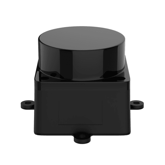
1 / 1Cogalloy MS200 Compact 360° dToF 2D LiDAR
Cogalloy MS200 is a compact 40 g, 360° single-line dToF LiDAR for ROS / ROS 2 mapping, localization and planar obstacle perception. Choose it over RPLIDAR C1 when tight mass, 37.7 × 37.5 × 33 mm packaging and a compact 4-pin power/UART connection matter most; validate target materials and delivered firmware before relying on its 0.03–12 m, 90%-reflectivity specification.
- 40 g compact LiDAR module: 37.7 × 37.5 × 33 mm packaging for robots with tight mass and volume constraints.
- 4,500 samples/s: 0.8° at the 10 Hz default; platform documentation also cites 0.4° at 5 Hz.
- 0.03–12 m with its test condition: Published at 90% reflectivity—validate dark and difficult targets instead of assuming the same reach.
- 4-pin UART integration: Plan stable 5 V power, serial logic, mounting height and a verified scan frame before enabling navigation.
Price
US$89.99
No account or payment needed. We usually confirm availability, lead time, shipping, and total price within 12 hours.
Or email us directly: sales@cogalloy.comShipping options and final delivery cost are shown at checkout.
SYSTEM ROLE
Keep a compact module in a clear 2D role.
MS200 supplies a continuous horizontal LiDAR scan for mapping, localization and obstacle perception. It is a compact perception input, not a complete navigation stack and not a sensor for vertical scene geometry.
- 360° rotating scan with distance, angle, intensity and timestamp data.
- Use the installed scan height to target the obstacles that matter.
- Pair with the appropriate depth / 3D sensing only when vertical geometry is required.
COMPACT INTEGRATION
Use the 40 g form factor without hiding its dependencies.
The 37.7 × 37.5 × 33 mm module and 4-pin power/UART path make MS200 a strong fit where packaging is constrained. Still design regulated 5 V power, a compatible serial path, strain relief, a rigid level mount and a documented sensor-to-base transform.
- Retail supply specification: DC 5.0 V ±0.5 V with less than 100 mV ripple.
- Confirm delivered TX, RX, GND and VCC pinout before wiring; do not assume a generic USB cable is included.
- Validate raw scan and direction before configuring SLAM, localization or Nav2.
MEASUREMENT REALITY
Read “12 m” together with the surface condition.
MS200 publishes 0.03–12.0 m at 90% reflectivity. That figure is not interchangeable with C1’s separately documented 70% white-target and 10% black-target ranges. Treat black, glossy, transparent, angled and low obstacles as a final-robot test, not as a catalogue assumption.
- Typical accuracy: ±10 mm at 0.2–2.0 m and ±20 mm at 2.0–12.0 m under the published condition.
- 4,500 samples/s; default 10 Hz / 0.8° scan setting.
- Keep robot stopping and safety behavior independent of any maximum-range statement.
SELECTION GUIDE
When MS200 is the better choice than RPLIDAR C1.
Choose MS200 when a 40 g compact module and short 4-pin power/UART path are decisive. Choose C1 when the application needs explicitly published black-target behavior, 5 kHz / 0.72° typical sampling at 10 Hz, IP54 and the RPLIDAR ecosystem. Neither is a 3D LiDAR.
- MS200: smaller and lighter; published 4,500 samples/s.
- C1: published 5,000 samples/s, 0.72° typical at 10 Hz and IP54.
- Make the final choice after checking target surfaces, installed height, power, connector and software image.
Related tutorials
Build with your parts
IntermediateMS200 2D LiDAR: UART Bring-Up and Scan Acceptance
Validate the compact MS200 LiDAR power path, delivered 4-pin UART pinout and raw 360° scan before mapping.
Read tutorial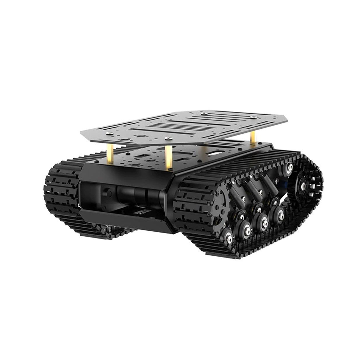 Advanced
Cogalloy T1 Advanced: Repeatable Navigation-Base Acceptance
Use a gated acceptance sequence for power, motion, odometry, LiDAR frames, mapping and supervised navigation on the tracked platform.
Read tutorialIntermediateURDF and TF: Frames for a Tracked Base, LiDAR and RGB-D Camera
Create a measured, inspectable frame tree for the base, MS200 LiDAR and Aurora930 Pro camera before mapping or perception.
Read tutorialProduct details
Everything you need to evaluate the fit.
Clear product information, technical specifications and compatibility details—kept separate from the purchase decision.
Overview
A compact 2D LiDAR for a real robot integration path
Cogalloy MS200 is a rotating, single-line dToF LiDAR. It returns distance, angle, intensity and timestamp data around one horizontal plane for mapping, localization and obstacle perception. It is not a depth camera and not a 3D LiDAR: objects above or below the installed scan plane are not measured.
Choose MS200 or RPLIDAR C1 deliberately
Both MS200 and RPLIDAR C1 are 360° 2D dToF LiDARs with UART integration and ROS / ROS 2 workflows. Choose MS200 when the robot needs the smaller 37.7 × 37.5 × 33 mm, approximately 40 g module, a compact 4-pin power/UART path and a published 4,500 samples/s scan. At the 10 Hz default, the published angular resolution is 0.8°; platform documentation also cites 0.4° at 5 Hz.
Choose RPLIDAR C1 when explicit low-reflectivity target figures, 5,000 samples/s / 0.72° typical at 10 Hz, IP54 protection and the RPLIDAR development-kit ecosystem matter more than compact size. Do not compare the two 12 m claims as like-for-like: MS200's published 0.03–12 m value is at 90% reflectivity, while C1 separately publishes 12 m for a 70% white target and 6 m for a 10% black target.
Integrate the module, not just the scan
Reserve regulated 5 V power, an appropriate UART/driver path and a rigid level mounting surface. The four-pin connection carries power and serial data; verify the delivered cable, logic level and pinout before assembly. Define the sensor-to-base transform, confirm scan direction and route the cable away from moving parts. The visible product may be small, but its scan plane, installed height, target surfaces and robot speed still determine whether it is useful.
Use an acceptance sequence before navigation
On the completed robot, verify stable power, raw data, a known static target, the coordinate frame and controlled motion with representative obstacles. The published range is measured under a high-reflectivity condition. Test dark, glossy, transparent, angled and low targets in the actual lighting; do not let the 12 m headline substitute for independent robot safety behavior.
Technical specifications
Weight
About 40 g
Connector
Compact 4-pin power / data connector; confirm delivered TX, RX, GND and 5 V pinout before assembly
Dimensions
37.7 × 37.5 × 33.0 mm
Protection
IP5X
Data output
Distance, angle, intensity and timestamp
Laser safety
Class 1, IEC 60825-1:2014
Light source
Modulated near-infrared laser
Product role
Compact 360° single-line 2D LiDAR for mapping, localization and planar obstacle perception
Data geometry
One horizontal scan plane; objects above or below the plane are not measured
Sampling rate
4,500 samples/s
Data interface
Standard asynchronous UART
Scan frequency
7–15 Hz; 10 Hz default. Some platform materials state 5–15 Hz; verify the delivered firmware / driver range.
Supply voltage
DC 5.0 V ±0.5 V
Voltage ripple
<100 mV
Start-up current
<500 mA in the retail specification
Operating current
260 mA typical; 300 mA maximum in the retail specification
Angular resolution
0.8° at 10 Hz; platform materials also cite 0.4° at 5 Hz
Selection boundary
Choose over RPLIDAR C1 for a much smaller / lighter module and 4-pin integration; choose C1 for explicit low-reflectivity data, denser 10 Hz sampling and IP54
Storage temperature
−30 to 70 °C
Measurement accuracy
Typical ±10 mm at 0.2–2.0 m; ±20 mm at 2.0–12.0 m (90% reflectivity)
Host and software fit
Windows PC software plus ROS 1 / ROS 2 support listed for the platform; UART driver and scan frame setup remain required
Measurement precision
Typical ≤4 mm at 0.2–2.0 m; ≤15 mm at 2.0–12.0 m
Measurement principle
Direct time-of-flight (dToF) rotating laser ranging
Operating temperature
−10 to 50 °C
Range comparison note
No separate 10%-reflectivity black-target range is published here; validate representative target materials on the delivered module
Ambient-light resistance
30,000 lux in the retail specification; validate direct sunlight and harsh lighting on the completed robot
First acceptance sequence
Power → raw scan → known target → coordinate frame → controlled-motion obstacle test
Published measurement range
0.03–12.0 m at 90% reflectivity
Shipping & support
Choose your destination at checkout to see the available shipping methods. Need integration advice before ordering? Our support team can help you choose compatible components.
In the box
Package contents
Cogalloy MS200 LiDAR module
Compact rotating 360° dToF 2D LiDAR with a 4-pin power / data connection.
Power/data lead, UART/USB bridge and mounting parts
Cable, adapter and bracket content depends on the ordered configuration. Do not assume a host USB adapter or mounting hardware is included unless it appears on the order confirmation.
Matched software materials
Use the viewer, driver, SDK / ROS resources that match the delivered module and host environment; software does not replace final system validation.
Expert support
Frequently asked questions
How is Cogalloy MS200 different from RPLIDAR C1?
Both are rotating 360° single-line 2D dToF LiDARs for a horizontal navigation scan. MS200 is about 40 g and 37.7 × 37.5 × 33 mm with a compact 4-pin power/UART path, while C1 is 110 g and publishes 5 kHz / 0.72° typical at 10 Hz, IP54 and a 10%-reflectivity black-target range. Choose MS200 for tight packaging; choose C1 when those documented low-reflectivity and protection characteristics are more important.
Are the two 12 m range claims directly comparable?
No. MS200 publishes 0.03–12.0 m at 90% reflectivity. C1 publishes 0.05–12 m for a 70% white target and 0.05–6 m for a 10% black target. These are different test conditions, so real target-material testing should decide the final choice.
Does the 0.03 m minimum range work in every robot installation?
Treat it as a published condition, not a guaranteed safety boundary. The minimum usable range can change with target reflectivity, angle, ambient light, enclosure geometry, mounting height and firmware. Validate the close obstacle or floor geometry that matters on the delivered module.
Can I use MS200 with Raspberry Pi, Jetson or ROS 2?
Yes, where the host has a compatible UART path and matching driver. The platform lists Windows PC software and ROS 1 / ROS 2 support. You must still verify serial access, scan direction, coordinate frames, mounting and robot-specific safety behavior.
What arrives with the MS200?
The LiDAR module is the fixed item. Cable, UART/USB adapter and mounting parts depend on the ordered configuration, so use the order confirmation as the source of truth rather than assuming a generic accessory bundle.
Is MS200 a 3D LiDAR, or suitable for every outdoor / transparent object?
No. MS200 measures one horizontal plane and does not provide vertical scene geometry. The retail specification lists 30,000 lux ambient-light resistance, but direct sunlight, dark, glossy, transparent, low and angled targets must be tested on the finished robot before the scan is used for autonomous behavior.